
CAD & Data Processing Services: Precision, Efficiency, and Insight for Every Project
Computer-aided design (CAD) and data processing services are essential tools for transforming raw survey data into actionable insights.
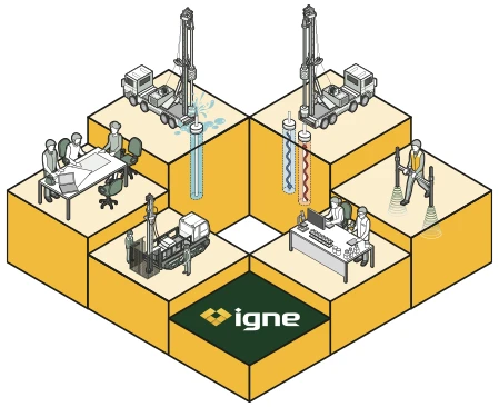
ABOUT
What are CAD & Data Processing Services?
CAD enables the creation of accurate, detailed drawings and 3D models, while data processing involves analysing large volumes of survey data to extract valuable information. These services are widely used across industries like construction, engineering, and property development to help plan, design, and manage projects efficiently.
At Igne, our CAD and data processing services cover everything from generating building information modelling (BIM) and Revit models to visualising site data through video, calculating stockpile volumes, and analysing terrain changes for cut-and-fill requirements.
Whether you're working on a large infrastructure project, a commercial development, or a residential site, our services ensure that you have the precise data and designs you need to move forward with confidence.
Useage
Why are CAD & Data Processing Services Useful, and for Whom?
CAD and data processing services are incredibly valuable for a wide range of professionals, including:
Engineers & Architects
CAD services provide accurate drawings and 3D models that are crucial for designing infrastructure, buildings, and landscapes. Data processing allows engineers to interpret site surveys and integrate findings into their designs, ensuring a seamless workflow from data collection to project execution.
Construction Teams
Construction managers and teams rely on accurate CAD drawings and processed survey data to manage the build process. Having detailed models of a site’s existing conditions helps teams plan and execute efficiently while avoiding unexpected issues.
Developers & Planners
Property developers use CAD and data processing to visualise and plan developments, optimise space, and ensure compliance with local regulations. Having accurate site data also helps in estimating costs and making informed decisions during the acquisition phase.
Environmental Scientists & Surveyors
For projects involving environmental considerations, CAD and data processing can create detailed maps and models of topography, watercourses, and vegetation. This helps in managing resources, mitigating risks, and ensuring sustainability in development projects.
unparalleled Service
Why Choose Igne for CAD & Data Processing Services?
Igne’s experience and expertise in site investigation make us the ideal partner for CAD and data processing services. We understand that accurate, reliable data is essential for the success of any project, whether you're planning a new development or managing an existing one. With state-of-the-art technology and a team of experts, we provide data and CAD models that are precise, actionable, and tailored to your project’s needs.
Our services are not only comprehensive but also highly flexible. We offer a wide range of data processing services, from simple 2D drawings to complex 3D models, volumetric calculations, and terrain analysis.
Our focus on quality and accuracy ensures that your designs and project plans are based on the most detailed and up-to-date information available.
By choosing us, you benefit from:
Expertise
Our team has extensive experience in geotechnical and site investigation projects, providing deep insights into both data processing and CAD modelling.
Technology
We use the latest tools and software, including industry-standard CAD platforms, to ensure high-quality results.
Tailored Solutions
Every project is unique, and we customise our services to meet the specific requirements of your project, ensuring that you get exactly what you need.
Risks
The Risks of Not Choosing the Right Professionals for CAD & Data Processing Services
Selecting the wrong provider for your CAD and data processing needs can result in significant risks that could impact your project's timeline, budget, and success:
Inaccurate Data
Without experienced professionals, data might be processed incorrectly, leading to flawed models and designs. Inaccurate drawings or models could result in costly mistakes during construction or delays in project approval.
Wasted Resources
Poor data processing can lead to misinformed decisions, wasted materials, or rework during the project. This can lead to increased costs and inefficiencies.
Missed Deadlines
Inadequate CAD services can cause delays in obtaining the necessary permits or approvals, which can set your project back. Having reliable data ensures that all stakeholders are informed and can act swiftly.
Compliance Issues
Poorly processed data might result in designs that fail to meet local regulations or planning requirements, causing legal complications and additional expenses.
Benefits
The Benefits of Having Igne Provide Your CAD & Data Processing Services
Working with Igne for your CAD and data processing services provides several key benefits that ensure the success of your project:
Precision & Accuracy
Our CAD drawings and 3D models are generated with a focus on precision, ensuring that every detail is accounted for. This helps avoid costly errors and ensures that projects are built to specifications.
Efficiency
We process data quickly and efficiently, helping you meet project deadlines without compromising on quality. Our team’s experience allows us to streamline the process, so you get the results you need faster.
Data Integration
Igne’s expertise in geotechnical and environmental surveys means that we can seamlessly integrate site data into your designs. This ensures that your CAD models reflect real-world conditions accurately.
Cost Savings
Accurate data and well-designed CAD models help to optimise project resources, reducing the likelihood of waste or rework. This can result in significant cost savings throughout the project lifecycle.
Cutting edge
What Equipment is Used for CAD & Data Processing Services?
Igne uses industry-standard tools and software to provide high-quality CAD and data processing services, including:
AutoCAD and Revit
These platforms allow us to create detailed 2D and 3D drawings, as well as complex building information modelling (BIM) designs.
Sonar & UAV Data
For survey data collection, we use advanced sonar systems and unmanned aerial vehicles (UAVs) to capture high-resolution site data that is then processed into actionable insights.
GIS & Geospatial Mapping Software
For data processing, we use GIS (Geographic Information System) tools that enable precise mapping and analysis of geographic data, including topographical and multispectral information.
Process
How is CAD & Data Processing Actually Done?
The process of CAD and data processing typically follows these five key steps:
- Data Collection
The process begins with the collection of raw data from the site, using methods such as UAV surveys, ground-penetrating radar, or manual site measurements. - Data Input
Once the data is collected, it is entered into specialised software, such as AutoCAD or GIS tools, where it is processed and formatted for analysis. - Data Analysis
The collected data is then analysed to identify key features, contours, volumes, and other relevant information about the site. This stage is crucial for generating accurate models and drawings. - CAD Modelling
Using the processed data, our team creates 2D or 3D models that represent the site in detail. These models can include terrain contours, building designs, volumetric data, and more. - Reporting & Visualisation
The final models are then compiled into reports or visualisations that are easy to interpret and share with stakeholders, ensuring everyone has a clear understanding of the project’s data and design.
Learn More
Frequently Asked Questions about CAD & Data Processing Services
- What is the difference between 2D CAD and 3D CAD?
2D CAD focuses on creating flat drawings or schematics, while 3D CAD involves building three-dimensional models that provide a more detailed representation of structures or landscapes.
- What industries benefit most from CAD and data processing services?
CAD and data processing services are used across various industries, including construction, engineering, architecture, property development, and environmental management.
- Can CAD models be integrated with BIM?
Yes, CAD models can be integrated with BIM platforms like Revit, which helps in managing the entire lifecycle of a building or infrastructure project.
- What is volumetric calculation in data processing?
Volumetric calculation refers to measuring the volume of materials, such as stockpiles of earth or aggregates, to estimate quantities for transportation, use, or storage.
- How accurate is data processing for cut and fill calculations?
Data processing for cut and fill calculations is highly accurate when done by experienced professionals, as it takes into account the precise terrain data and volume changes required for construction projects.
Learn More about Specific CAD & Data Processing Services
The next step
Learn how Igne’s CAD & data processing services can benefit your project.
Explore our full range of services, including BIM and Revit modelling, volumetric calculations, and video visualisations.
Contact our survey team today to discuss how we can help you achieve precision, efficiency, and success in your next project.
Topographical Surveys
These map the physical features of a site, including elevation changes, natural features, and man-made structures. Topographical surveys provide a detailed understanding of the site’s layout, which is essential for planning and design.
Utility Surveys
Utility surveys locate and map underground utilities such as gas lines, water pipes, electrical cables, and sewers. This is critical for avoiding costly damage during excavation and construction.
GPR (Ground Penetrating Radar) Surveys
GPR surveys use radar pulses to image the subsurface, identifying buried objects, voids, and changes in material properties. GPR is particularly useful for detecting utilities, rebar, and other subsurface features.
Measured Building Surveys
These provide accurate measurements of existing buildings, including floor plans, elevations, and cross-sections. They are essential for refurbishment, renovation, or extension projects.
Monitoring Surveys
Monitoring surveys track changes in a site over time, such as ground movement, settlement, or structural deformation. These surveys are vital for ensuring the ongoing safety and stability of a site.
Drone (UAV) Surveys
Drone surveys offer aerial mapping and photography, providing a bird’s-eye view of the site. They are ideal for large or difficult-to-access areas, delivering high-resolution data quickly and efficiently.
Bathymetric Surveys
Bathymetric surveys measure the depth and topography of underwater sites, such as rivers, lakes, and coastal areas. These surveys are essential for projects involving water bodies or marine environments.
CAD & Data Processing
After data collection, our CAD and data processing services transform raw survey data into detailed maps, models, and reports. This information is presented in a format that is easy to understand and use for further planning and design.