
Bathymetric Surveys: Understanding Underwater Terrain
Bathymetric surveys map the underwater topography of rivers, lakes, reservoirs, and other water bodies.
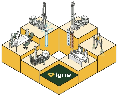
About
What are Bathymetric Surveys?
Using sonar technology, these surveys measure the depth and contours of the waterbed, generating highly detailed maps of underwater terrain. Bathymetric data is crucial for a variety of applications, including infrastructure development, flood management, navigation, and environmental monitoring.
Bathymetric surveys are often conducted using unmanned surface vehicles (USVs), which allow for safe, efficient, and accurate data collection in even the most challenging aquatic environments.
These surveys provide a comprehensive understanding of underwater conditions, making them an essential tool in the planning and execution of projects that interact with water bodies.
Useage
Why are Bathymetric Surveys Useful, and for Whom?
Bathymetric surveys are incredibly valuable across numerous sectors, providing critical data to a range of stakeholders:
Infrastructure & Construction Projects
Developers and engineers use bathymetric surveys to assess waterbed conditions before constructing bridges, piers, or other infrastructure. This ensures that project are built on stable ground, minimising the risk of subsidence or structural failure.
Environmental Monitoring & Conservation
Evironmental scientists and conservationists rely on bathymetric data to monitor changes in underwater ecosystems. These surveys help detect shifts in waterbed conditions, erosion, sedimentation, and other factors that affect aquatic environments.
Flood Risk Management
Government agencies and flood risk managers utilise bathymetric surveys to model water flow and volume in rivers and reservoirs. By understanding underwater terrain, authorities can better predict flood behaviour and develop more effective flood prevention strategies.
Navigation & Safety
Bathymetric surveys are also vital for ensuring the safety of vessels navigating inland waterways. By identifying underwater obstructions or shallow areas, these surveys help minimise the risk of collisions or grounding.
Trust
Why Choose Igne for Bathymetric Surveys?
Igne is an industry leader in geotechnical and environmental testing, with vast experience in site investigation for both terrestrial and aquatic environments. Our bathymetric surveys are conducted by a team of experts who understand the unique challenges of underwater data collection and interpretation. Using cutting-edge technology and USVs, Igne delivers accurate, high-resolution maps that are tailored to the specific needs of each project.
We are committed to providing solutions that de-risk projects, ensuring that you have the data necessary to make informed, confident decisions. Whether you’re planning a new infrastructure development, assessing environmental impacts, or managing flood risks, Igne’s bathymetric surveys offer the precision and reliability you need to succeed.
Our expertise spans a wide range of industries, and we pride ourselves on offering bespoke services that fit the scope and scale of any project. When you commission Igne for bathymetric surveys, you’re choosing a partner dedicated to ensuring your project’s safety, efficiency, and success.
Risk
The Risks of Not Conducting Bathymetric Surveys
Neglecting to conduct bathymetric surveys can lead to several significant risks, many of which could severely impact a project’s safety, timeline, and budget.
Structural Failures
For construction projects near or over water, not understanding the waterbed conditions could result in building on unstable or unsuitable ground. This increases the risk of subsidence, structural damage, or even catastrophic failure over time.
Flooding & Erosion
Without accurate bathymetric data, flood risk models may be incomplete, leading to insufficient flood protection measures. This can result in unpredicted flooding, property damage, and environmental harm.
Environmental Degradation
Failing to monitor underwater ecosystems can lead to undetected erosion, sediment build-up, or damage to aquatic habitats. This can have long-term consequences for biodiversity and water quality.
Navigational Hazards
For vessels navigating inland waterways, uncharted underwater obstructions or changing water depths can pose serious safety risks. Not conducting regular bathymetric surveys increases the likelihood of collisions or grounding
Benefits
The Benefits of Bathymetric Surveys
Bathymetric surveys offer a wide range of benefits that extend beyond basic data collection, enhancing the safety, sustainability, and success of projects.
Accurate, Real-Time Data
Bathymetric surveys provide highly detailed maps of underwater terrain, allowing for real-time data collection and analysis. This enables faster decision-making, especially in time-sensitive projects like flood risk management or emergency infrastructure repairs.
Non-Invasive Methodology
Using sonar technology and unmanned surface vehicles (USVs), bathymetric surveys are non-invasive and environmentally friendly. These surveys can be conducted without disturbing the aquatic environment or impacting local wildlife, making them ideal for sensitive ecosystems.
Cost-Effective
By identifying potential issues early in the project lifecycle, bathymetric surveys help prevent costly mistakes or delays. Accurate data on underwater conditions allows for better planning and risk management, reducing the likelihood of unexpected setbacks.
Comprehensive Coverage
Bathymetric surveys can cover large areas quickly, making them ideal for projects that span multiple locations or involve vast water bodies. This ensures that even the most remote or hard-to-reach areas are thoroughly examined.
Improved Safety
For projects involving vessels or personnel working on or near water, bathymetric surveys enhance safety by identifying potential hazards, such as submerged objects or unstable ground.
Process
How are Bathymetric Surveys Conducted?
Bathymetric surveys are conducted using a systematic approach to ensure accurate and reliable data collection:
- Planning & Site Assessment
The first step involves planning the survey, selecting the appropriate technology, and assessing the site to determine the scope of the project. - USV Deployment
Unmanned surface vehicles equipped with sonar systems are deployed on the water body. These vehicles scan the underwater terrain, collecting depth and contour data across the survey area. - Data Processing
The data gathered by the USV is processed using specialised software to create detailed maps and models of the underwater landscape. These maps highlight depth variations, underwater features, and any potential obstructions. - Analysis & Reporting
Igne’s team of experts analyse the processed data, providing comprehensive reports that include detailed bathymetric maps and recommendations for further action.
Learn More
Frequently Asked Questions about Bathymetric Surveys
- What technology is used in bathymetric surveys?
Bathymetric surveys typically use sonar technology, which sends sound waves to the waterbed and measures the time it takes for them to return. This data is used to map the depth and contours of the underwater terrain.
- Can bathymetric surveys be done in small water bodies?
Yes, bathymetric surveys can be conducted in a wide range of water bodies, from small rivers and ponds to large lakes and reservoirs. USVs are particularly useful for smaller, hard-to-access areas.
- How often should bathymetric surveys be conducted?
The frequency of bathymetric surveys depends on the specific needs of the project. For environmental monitoring or flood risk management, regular surveys are recommended to track changes in underwater terrain over time.
- What are USV inland water surveys?
USV inland water surveys use unmanned surface vehicles to map rivers, lakes, and other inland water bodies. These surveys are critical for infrastructure development, flood management, and environmental monitoring in inland areas.
- What are river cross and long section surveys?
River cross and long section surveys map the profile of a riverbed, measuring depth along the width and length of the river. These surveys are vital for understanding water flow, erosion patterns, and flood risks.
Learn More about Specific Bathymetric Surveys
The Next Step
Discover how Igne’s bathymetric surveys can provide critical insights for your next project.
Whether you're planning an infrastructure development, managing flood risks, or conducting environmental monitoring, we have the expertise to help.
Explore our full range of surveys, including USV inland water surveys and river cross/long sections, and contact us today to discuss your specific needs.
Topographical Surveys
These map the physical features of a site, including elevation changes, natural features, and man-made structures. Topographical surveys provide a detailed understanding of the site’s layout, which is essential for planning and design.
Utility Surveys
Utility surveys locate and map underground utilities such as gas lines, water pipes, electrical cables, and sewers. This is critical for avoiding costly damage during excavation and construction.
GPR (Ground Penetrating Radar) Surveys
GPR surveys use radar pulses to image the subsurface, identifying buried objects, voids, and changes in material properties. GPR is particularly useful for detecting utilities, rebar, and other subsurface features.
Measured Building Surveys
These provide accurate measurements of existing buildings, including floor plans, elevations, and cross-sections. They are essential for refurbishment, renovation, or extension projects.
Monitoring Surveys
Monitoring surveys track changes in a site over time, such as ground movement, settlement, or structural deformation. These surveys are vital for ensuring the ongoing safety and stability of a site.
Drone (UAV) Surveys
Drone surveys offer aerial mapping and photography, providing a bird’s-eye view of the site. They are ideal for large or difficult-to-access areas, delivering high-resolution data quickly and efficiently.
Bathymetric Surveys
Bathymetric surveys measure the depth and topography of underwater sites, such as rivers, lakes, and coastal areas. These surveys are essential for projects involving water bodies or marine environments.
CAD & Data Processing
After data collection, our CAD and data processing services transform raw survey data into detailed maps, models, and reports. This information is presented in a format that is easy to understand and use for further planning and design.