
UXO Risk Mapping
Discover how our unexploded ordnance (UXO) research team identify, utilise, and analyse multiple map sources to build comprehensive risk assessments for our clients’ construction or development project sites.
The level of detail they explore and the data they deliver is exemplary, and its why Igne’s clients return time and again to their most trusted UXO expert friends.
Bomb Census Maps: Visualising Blitzed Britain
During WWII, Air Raid Precaution (ARP) wardens created visual maps of bomb strike locations as accurately as possible from their vantage points. Many of these maps have survived and are useful for understanding the spread and direction of bombing near construction and development sites, as well as the proximity and coverage of incendiary bomb showers.
The quality of these maps varies significantly. Some provide broad, county-wide coverage with limited geographical indicators, making precise assessments challenging. Others, particularly those plotted onto large-scale Ordnance Survey (OS) maps, offer detailed local coverage, pinpointing exact bomb strikes on specific properties. Additional details such as damage levels and ARP warden vantage points further enhance the usefulness of these maps.
Bomb Damage Maps: Assessing Impact
In areas heavily affected by bombing raids, detailed bomb damage maps were occasionally produced. Central London, for instance, has comprehensive maps indicating damage levels, from light blast damage to complete destruction. While these maps are less common than bomb plot maps, they are invaluable for understanding wartime site conditions. When combined with bomb plot maps or other records, they offer a clear picture of the extent of damage from specific incidents.
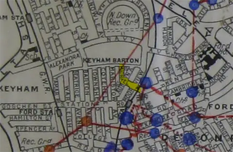
Ordnance Survey Maps: Tracking Landscape Changes
OS maps are crucial for tracking landscape changes over time. By comparing pre- and post-WWII maps, we gain insights into the potential impacts of bombing on client project sites. Post-war maps often highlight ruins, clearance areas, and redevelopment zones, indicating bomb damage. When used alongside historical bombing data, these maps help us build a comprehensive picture of wartime site conditions and potential UXO contamination.
Military Maps
Training Area Maps: Igne uses maps to assess potential risks from both German and British sources. Training area maps indicate sections of the country requisitioned for military live training exercises, which could pose UXO risks.
Minefield Maps: These maps show offshore sections mined by British and German navies, helping to identify underwater UXO hazards.
Defensive Structure Maps: Maps detailing defensive structures and stop lines highlight towns with heavy defences, providing insights into areas with a higher likelihood of UXO presence.
Airfield Plans: Plans and maps of airfields identify notable structures and buildings near project sites, often showing the location of bomb stores.
Igne also maintains a comprehensive internal database of historical data on its own UXO maps, allowing for quick identification of any features of interest on or near client project sites. These maps are especially useful for consultation with our clients at the earliest stages of project planning, and also help us to shape our Preliminary UXO Risk Assessments.
Other Maps: International Perspectives
For international projects, Igne acquires historical maps to understand the conflict history of client sites and surrounding areas. These maps may depict camps, stores, troop movements, former battlefields, trench locations, training areas, U-boat pens, dump sites, shipwreck locations, and more.
Risk Maps: Visualising Potential Hazards
After gathering all available historical information, Igne assigns risk levels across client sites. In some cases, the risk level is consistent throughout the site, but often, varying risk levels necessitate the creation of detailed risk maps. These maps are produced using mapping software and are overlaid onto the site plan to visually represent the assessed risks.
Conclusion: The Power of Maps
Maps are critical to Igne’s UXO risk assessments, providing essential historical context and enhancing other data sources. They place information in a visual format, making evidence clearer and comparisons more efficient and accurate. Through advanced mapping software, Igne overlays historical and risk maps onto our clients’ site plans, ensuring thorough and precise UXO risk assessments for safe and informed project planning.
No matter where in the world you’re planning your next project, and whether you’re piling ground or landing cables on the seabed, Igne’s unexploded ordnance research team will provide you with a comprehensive risk assessment, built from multiple datasets, to keep your project and your personnel safe from the lethal legacy of military action. Contact them directly.
Other articles of interest

How Igne’s UXO risk assessments keep clients on time and budget
Igne’s research team create detailed UXO risk assessments so clients can determine the risk level of their sites.
Expert Opinion for the BBC
As news coverage of the Plymouth bomb find continues, Igne's Explosive Ordnance Disposal (EOD) and research experts have been cited by the BBC and regional press, and have provided insight into what the Army may do next, and how insurers may involve an 'occasioned by war' clause to avoid paying out for any potential damage.